 eAtlas Data Catalogue
Charles Darwin University
Type of resources
Topics
Keywords
Contact for the resource
Provided by
Years
status
-
This record provides an overview of the NESP Marine and Coastal Hub small-scale study - "Mapping critical habitat in Yanyuwa Sea Country". For specific data outputs from this project, please see child records associated with this metadata. Marra and li-Anthawirriyarra rangers seek to build on existing partnerships with CDU and JCU to map the intertidal habitats of the Yanyuwa Indigenous Protected Area (IPA) and coastal areas connected to it, an area of profound importance to these communities and the marine ecosystem of the Gulf of Carpentaria (GoC). Significant co-funding will be provided by the Mabunji Aboriginal Corporation (MAC) and DAWE Migratory Species Section to conduct a large-scale mapping project that will inform Marra and Yanyuwa community decisions that underpin sustainable management and facilitate continued connection with sea country. Co-funding from NESP2 is sought to provide salary for data processing and reporting for these surveys. This project also leverages existing funding allocated to training, capacity building, community consultation and communication products committed to by the rangers, CDU, JCU, the Australian and the NT Governments. Planned Outputs • Benthic survey data and habitat maps [spatial dataset] • Final technical report with analysed data and a short summary of recommendations for policy makers of key findings [written]
-
This record provides an overview of the NESP Marine and Coastal Hub study - NESP MaC Project 3.19: Addressing Kakadu’s strategic marine research needs. The Indigenous-owned lands of Kakadu National Park are World Heritage-listed and globally significant. The natural and cultural values of Kakadu are at risk from a range of threats that will intensify over time. To prioritise the management of these threats, there is a pressing need to develop a Kakadu research strategy. The NESP Resilient Landscapes Hub have already committed a project within RP2022 to work with Traditional Owners and Park managers to develop a research strategy for Kakadu National Park. Investment from the NESP Marine and Coastal Hub in RP2023 will value-add to this existing project and enable the inclusion of marine and coastal issues into this research strategy. This project will deliver a research strategy that will provide guidance on both what research needs to be done and how it should be conducted in Kakadu. The Kakadu Indigenous Research Committee (KIRC) has been operating successfully for the past 5 years and the park has been the location for several Indigenous-led research projects that demonstrated best-practice approaches for collaborative research. Planned Outputs • Final technical report with updated list of Bininj/Mungguy research priorities and updated Kakadu research protocols [written] • Draft Kakadu research strategy and a list of priority projects [written]
-
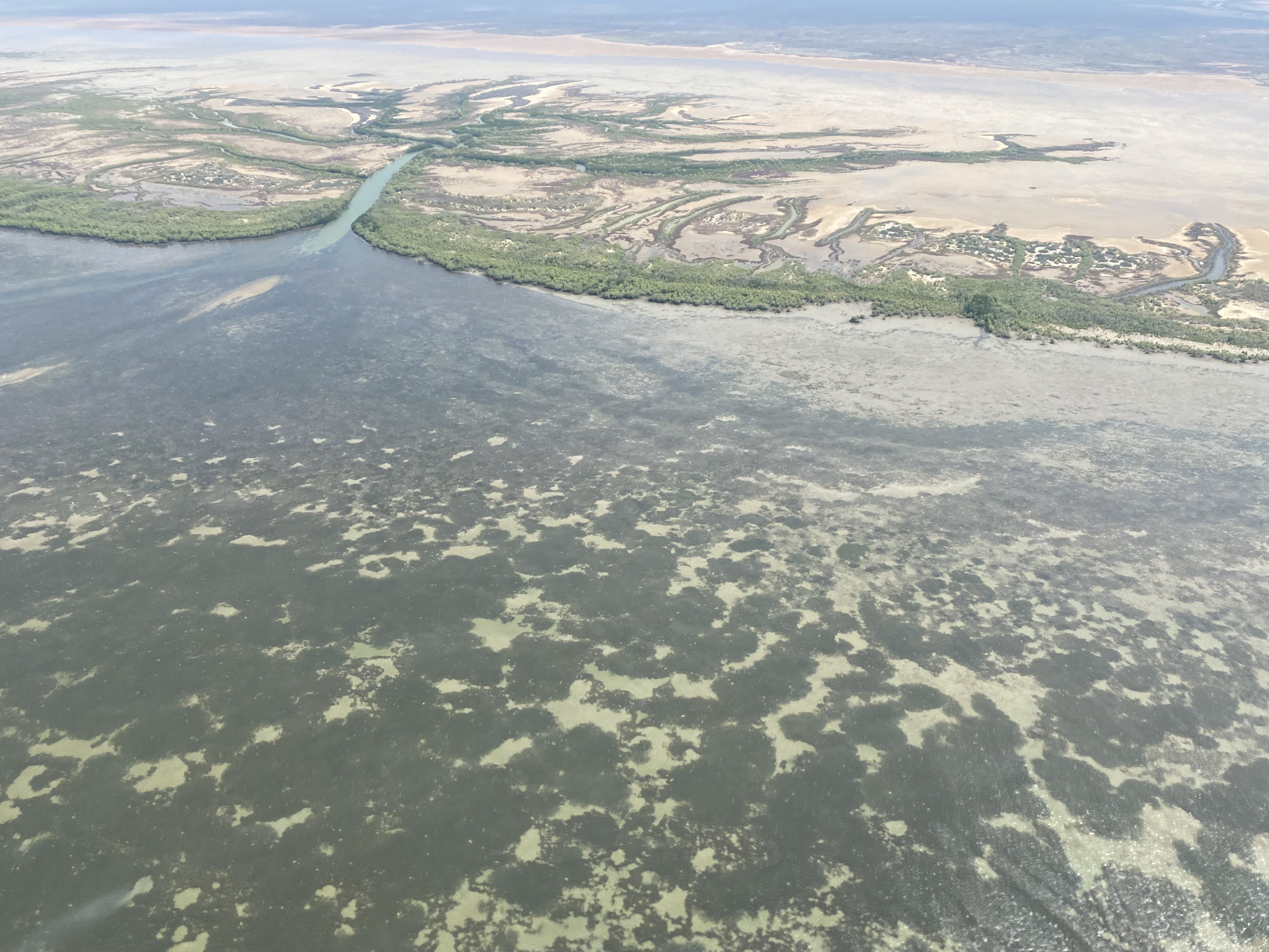
This record provides an overview of the NESP Marine and Coastal Hub study - Assessing dugong distribution and abundance in the southern Gulf of Carpentaria. For specific data outputs from this project, please see child records associated with this metadata. Aboriginal ranger groups, Traditional Owners of the southern Gulf of Carpentaria (sGoC), scientists, Queensland, Northern Territory and Commonwealth government representatives will co-design and implement a program that enables a contemporary cross-border understanding of dugong populations and other marine megafauna. The dugong program comprises three parts: 1) Dugong population genetics, 2) a standardised aerial survey in the sGoC, and 3) Indigenous-led drone surveys of marine megafauna hotspots. The collaborative approach will enable contemporary data on abundance, distribution and genetic population structuring to inform local and regional conservation management actions. In combination with other NESP investments in Qld and WA, this program will have applied consistent approaches to dugong population assessment across three states. This program directly responds to the national priorities of conserving, protecting and sustainably managing biodiversity through research and information management. Planned Outputs • dugong distribution & abundance [spatial dataset] • Final technical report with analysed data and a short summary of recommendations for policy makers of key findings [written]
-
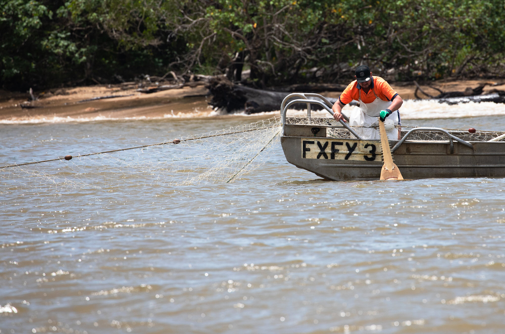
This record provides an overview of the NESP Marine and Coastal Hub study - Project 3.11 - Multi- fishery collaboration to assess population abundances and post release survival of threatened sawfish in northern Australia. For specific data outputs from this project, please see child records associated with this metadata. To improve sawfish reporting and obtain an estimate of sawfish abundance and stock structure, a large-scale collaborative project is proposed between industry, State and Commonwealth agencies and lead research institutions to gather tissue samples from across northern Australia. The project will have a focus on developing trust between research and the commercial fishing industry that will achieve the following: - Industry led reporting and sampling programs will be established throughout Australia’s northern fisheries. - Tissue samples will be used to assess sawfish abundance and stock structure using Close-Kin Mark-Recapture (CKMR). - Estimates of post-release survival will be obtained from satellite tagging and improved reporting. - Data on abundance and post release survival will be used to assess the sustainability of sawfish bycatch. The research also aims to improve reporting of sawfish along with other EPBC listed species in northern Australian fisheries. If enough tissue samples are collected, close kin mark recapture will enable estimates of adult population size for four species of sawfish. Post release survival and abundance estimates will be used to determine the sustainability of sawfish captured as bycatch in state, territory and Commonwealth Fisheries. Improved estimates of bycatch, population connectivity, adult abundance and post release survival were identified as the highest research priorities in the Sawfish and River Shark multispecies recovery plan. Within Australia, three out of the four occurring species are listed as Vulnerable and Migratory under the EPBC act (Pristis pristis, P. zijsron and P. clavata). The fourth Australian species, narrow sawfish (Anoxypristis cuspidata) is listed as a Migratory species. Both A. cuspidata and P. pristis are currently under nomination to be up-listed to Endangered under the EPBC act. The Freshwater Sawfish Pristis pristis is also listed in the Threatened Species Strategy - 100 priority species for fish. Planned Outputs • Sawfish catch data [spatial dataset] • Tissue samples and sequencing data • Final technical report with analysed data and a short summary of recommendations for policy makers of key findings [written]
-
This record provides an overview of the NESP Marine and Coastal Hub small-scale study - Project 3.10 – A partnership approach to filling key knowledge gaps on dugongs in northern Australia using novel technologies . For specific data outputs from this project, please see child records associated with this metadata. In Australia, the dugong is protected under the EPBC Act 1999 as a listed migratory, and listed marine species, it is also a Matter of National Environmental Significance. The dugong is culturally significant to the coastal Aboriginal and Torres Strait Islander peoples of northern Australia and has a high biodiversity value. This project includes five activities that will contribute to addressing key knowledge gaps about the spatial and temporal patterns in the distribution, abundance, connectivity and health of dugong populations. The project is designed to inform management in several regions of high value habitat across northern Australia. Transversal to the activities described below is a strong partnership approach with Traditional Owners and members of the wider community. The project will be co-designed, co-produced and will co-deliver research and monitoring outputs. The studies will utilise and advance emerging technologies (e.g., aerial images collected from planes and drones, Artificial Intelligence, population genomics) with the ultimate goal of enhancing data quality, reducing research and monitoring costs, and increasing accessibility of monitoring tools to non-experts. Activity 1: Assessing trends in the distribution and abundance of dugongs during the transition to imagery surveys along the eastern coast of Queensland Activity 2: Assessing the trends in the distribution and abundance of dugongs during the transition to imagery survey in the Shark Bay and Ningaloo/Exmouth Gulf area Activity 3: Using population genomics approaches to identify populations and their level of connectivity across northern Australia Activity 4; Assessing the body size and body condition of dugongs using drone-based photogrammetry Activity 5: Developing community-led dugong monitoring with traditional owners in the Kimberley region. Planned Outputs • Dugong sighting location and count data from observer aerial survey data [spatial dataset] • Imagery from aerial surveys and photogrammetry • Genomic sequencing data and tissue samples • Statistical code or script files • Final technical report with analysed data and a short summary of recommendations for policy makers of key findings [written] • Peer-reviewed open access publication
-
This record provides an overview of the NESP Marine and Coastal Hub study - Project 3.20– A National Approach to Indigenous Engagement in Australia’s Blue Carbon and Environmental Markets. For specific data outputs from this project, please see child records associated with this metadata. Blue Carbon and Environmental markets, and their related environmental policy are rapidly evolving to meet National carbon reduction targets. In Australia, they’re emerging markets with great potential to improve carbon sequestration and restore biodiversity and cultural values. However, swift market growth infers the potential for perverse outcomes without proper regulation and processes implemented alongside. Corresponding regulation and processes are not yet in place to ensure Indigenous engagement is conducted in a legitimate, respectful, and empowering manner. The project proposes to coordinate a national Indigenous engagement approach for Blue Carbon and where appropriate include discussions on other Environmental market projects. This process will capture the wide-ranging rights and interests of Indigenous peoples and communities across jurisdictions and ensure empowerment in the Blue Carbon market. A key output from this research will be a document that outlines leading practice Indigenous engagement principles learned through a process of consultation with key Indigenous groups across Australia. It will be submitted to the Commonwealth government alongside proposed new Blue Carbon methods to enable efficient implementation that is ethical and in accord with leading practice principles of Indigenous engagement. The Blue Carbon market provides an opportunity for Indigenous community economic gain amidst complex legislation, tenure, resource ownership and co-benefits that haven’t been investigated in detail. Projects for the proposed Ungulate Method (Project 3.8) will occur on Aboriginal-owned land and mixed tenure where Indigenous people hold significant values and interests. Ensuring, Indigenous peoples rights, equity, and that principles of free, prior, and informed consent, are at the fore front of projects, leading practice Indigenous engagement is essential. The project notes that the legislative framework for the Blue Carbon market and how it relates to Indigenous peoples is different to other emerging environmental markets and it is likely to inherently limit the outcomes of this project. Planned Outputs • Mapping tenure of Blue Carbon resources [spatial dataset] • Final technical report with analysed data and recommendations for policy makers of key findings [written]
-
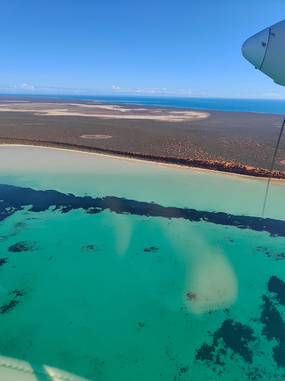
This record provides an overview of the NESP Marine and Coastal Hub study - Project 3.5 – Supporting regional planning in northern Australia: Building knowledge, skills and partnerships for understanding seagrass distribution. For specific data outputs from this project, please see child records associated with this metadata. Northern Australia has vast development opportunities but limited knowledge of the environment to inform decision making. This region has globally significant seagrass habitat, supporting dugong, green turtle, and commercially important fish and prawns. Key to managing impacts to species in these habitats is reliable data on seagrass distribution and how this changes over time. Achieving this requires large-scale mapping and a ranger-led monitoring network in remote communities. This project will map seagrass habitats across northern Australia through targeted mapping expeditions in data deficient regions. It will strengthen relationships with coastal communities, build-on existing knowledges and skills, co-design training resources with rangers to undertake monitoring, trial new technologies for monitoring, and synthesise historical and new seagrass data into an open access resource. Planned Outputs • Spatial GIS datasets [seagrass surveys] • Synthesised historical compilation [spatial dataset] • Final technical report with analysed data and a short summary of recommendations for policy makers of key findings [written]